Riomaggiore-Portovenere hike in Cinque Terre: complete guide
Whether you're in the process of making an itinerary for Cinque Terre or want to read about the fabulous trails in the area, you've come to the right place! If you want to know more details about how we got there and how we split our 4 days, I invite you to enter this link. In acest articol vei gasi informatii despre traseul Riomaggiore-Portovenere.
General information about the trail
About Portovenere
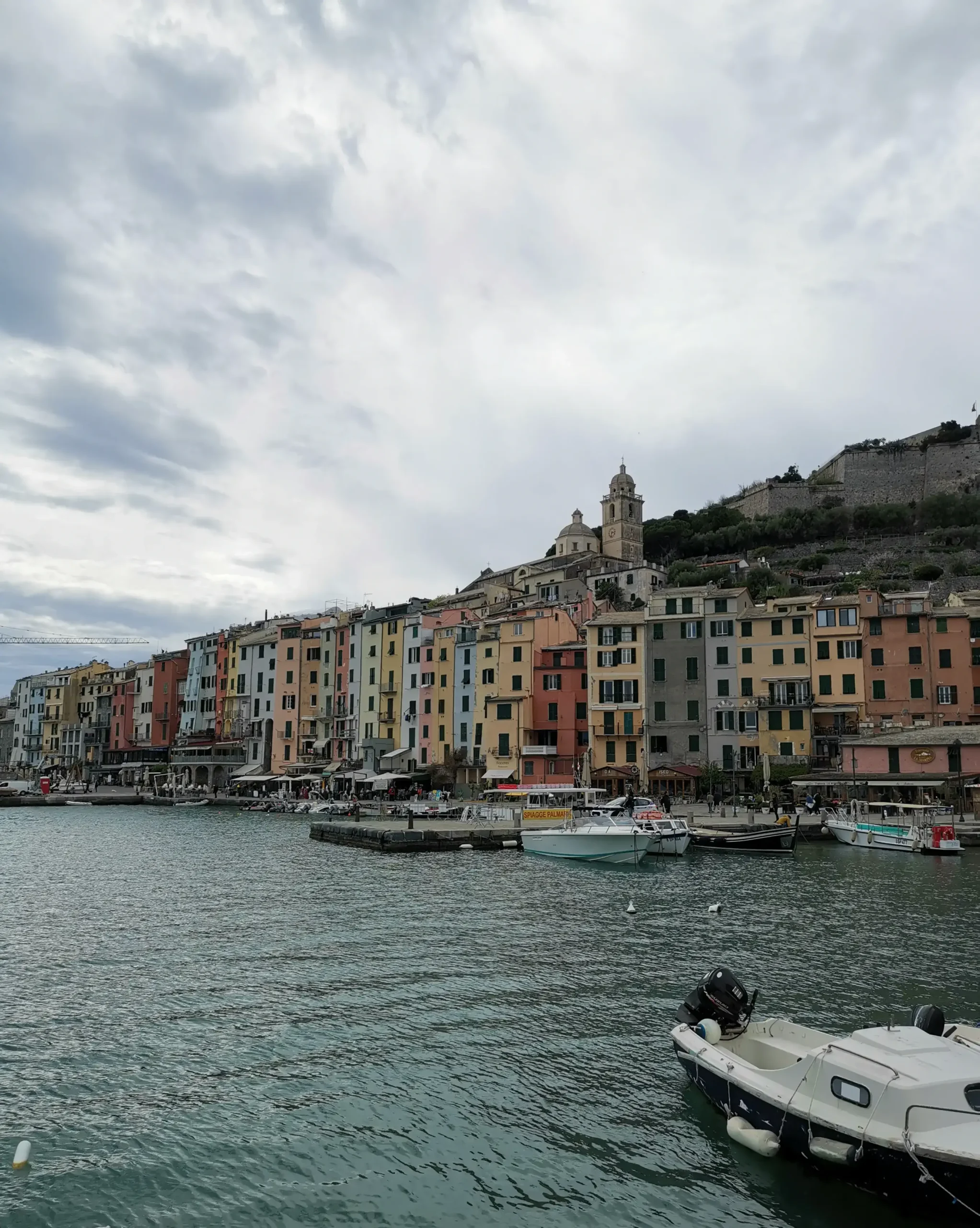
Portovenere, although not officially part of the Cinque Terre, it is considered just as beautiful and is unofficially listed as the 6th village. It's the furthest from the known area, at the tip of the peninsula and province LaSpezia. It is seen as a tourist destination for its natural beauty, rich history and romantic atmosphere being included in UNESCO World Heritage.
The only way to get there is either by boat from LaSpezia or Cinque Terre. There are also buses that take you to LaSpezia, but the road is very winding and takes much longer than by boat. For the last day we had two route options: either to Portovenere or Levanto. After looking for more details, we chose the one to Portovenere because of the location and the scenery, but also because it's not so popular among the tourists.
Everything you need to know about the trail
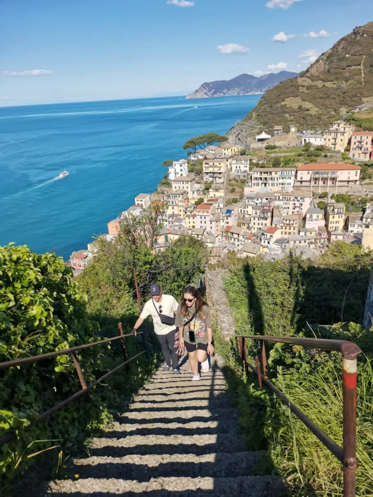
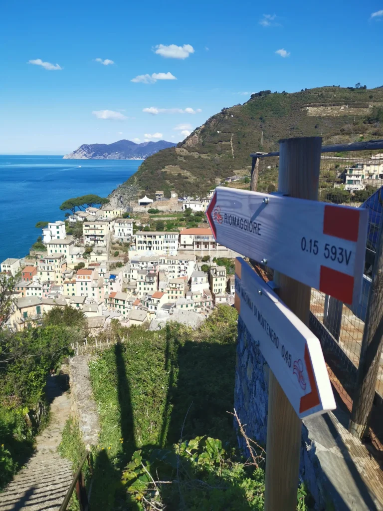
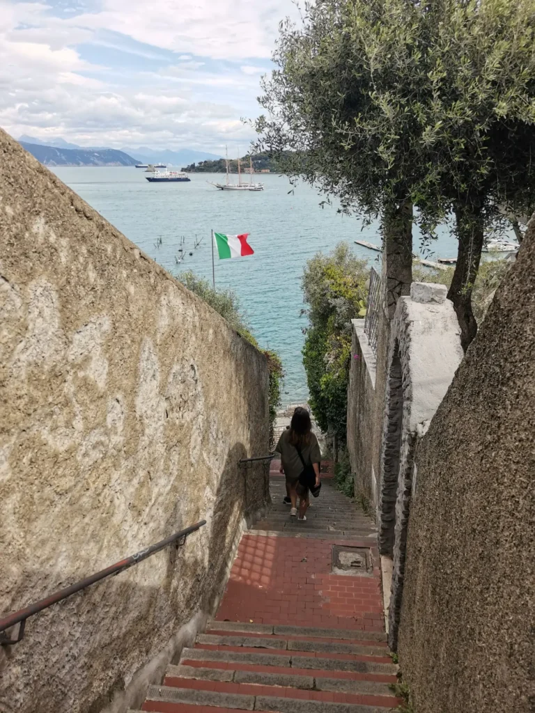
From Corniglia we took the train to Riomaggiore, and from the city center we walked towards the sign for Portovenere. To get out of Riomaggiore and to get to the actual trail there are many, many stairs to climb. It's quite challenging at the beginning of the trail and for a short section in length, it takes a very long time. But once you get to the top, the views towards Riomaggiore and the coast are stunning.
I recommend starting in this direction, regardless of this more difficult start, as the scenery along the way is gorgeous. I understand that there is a possibility to avoid all the stairs by taking a bus that takes you to Telegrafo, a scenic point along the route, but I couldn't find more information at that time. But you will get to this panoramic point anyway and you can catch your breath watching how beautiful the surroundings are.
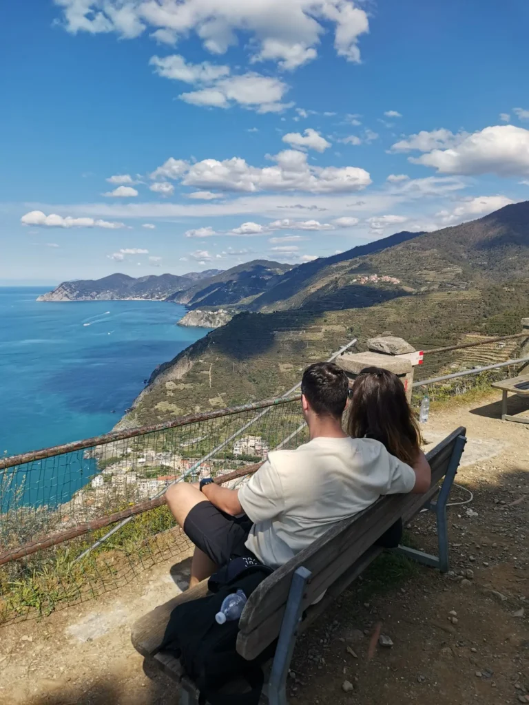
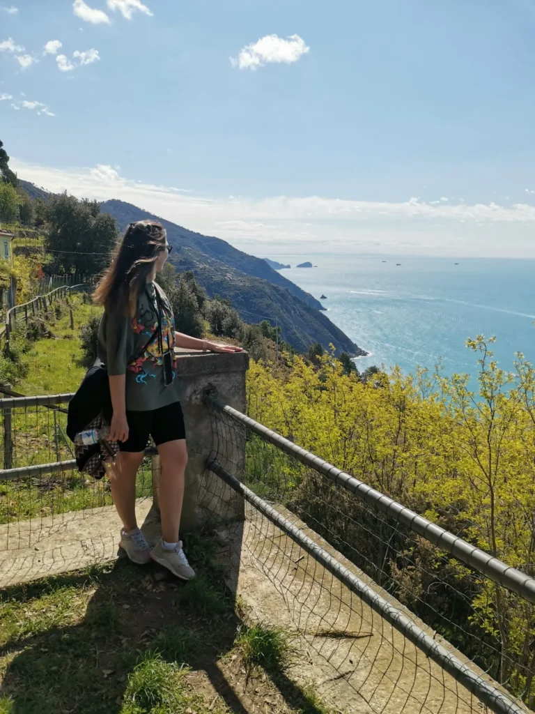
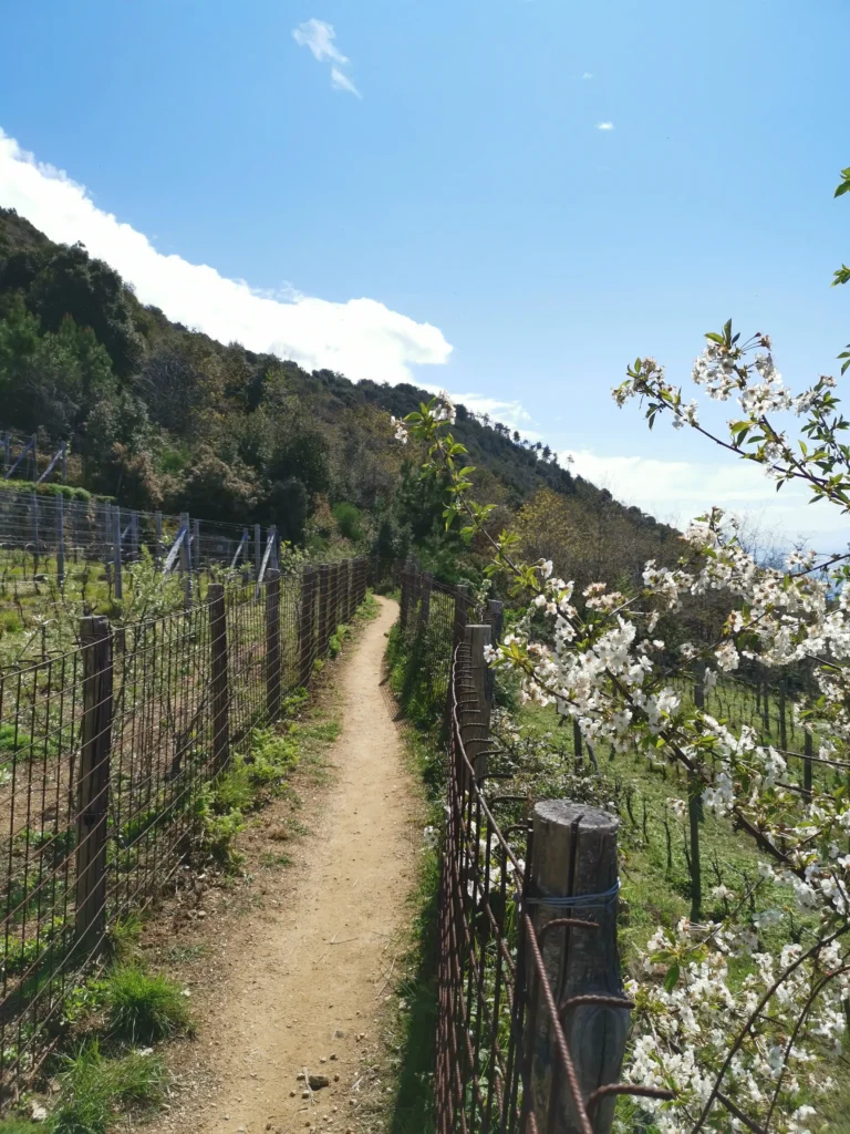
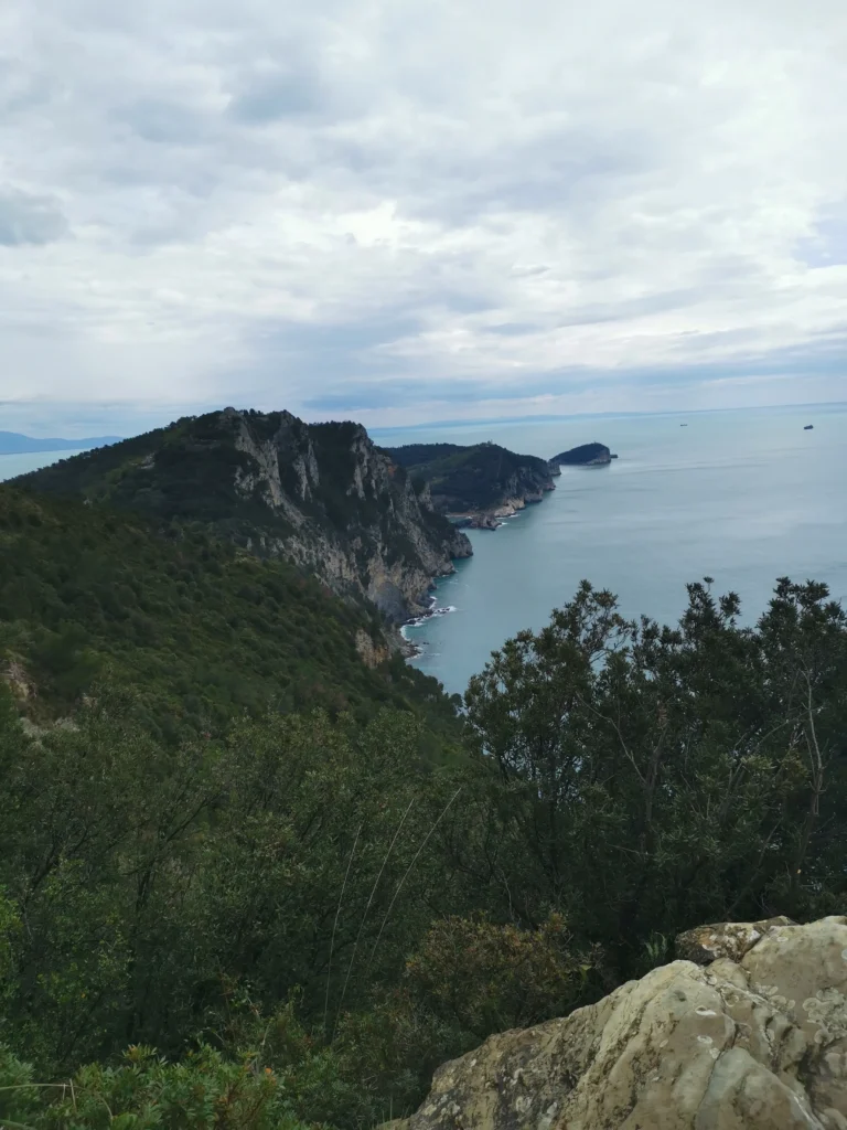
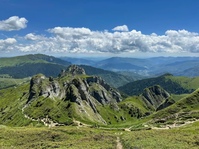
Unlike the other trails, this one is through forests of pines and it is the perfect feeling if you hike during a rainy day or a very hot summer day. From the halfway point, the road goes on rocks, it is not dangerous at all, but you have to be more careful and it requires more attention. But it's only now that you start to see the views that set this route apart from the others. Ahead you can see the tip of the peninsula and the small islands Tino and Tinetto, and on the right side there is the Mediterranean See and the islands Elba, Capraia, Korsika and Palmaria. On the left side the harbor of LaSpezia appears slightly out of the rocks.


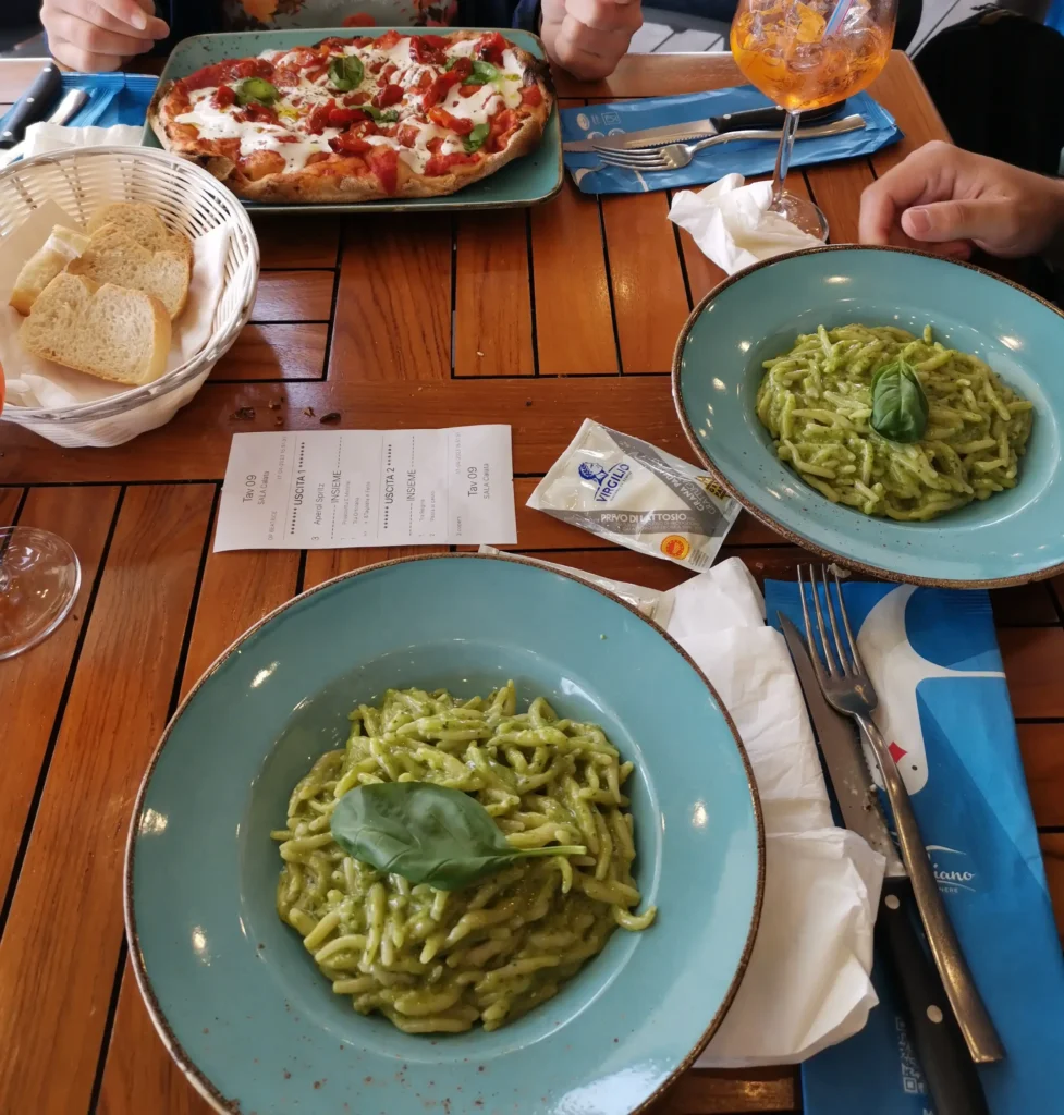
After this more exposed area, start the descent to Portovenere through the only village on the road, Campiglia Tramonti. It is also your only possibility to buy a water or a snack, but don't rely too much on this place. At the time we went, there was no shop open and no one was on the street, just very few tourists. From this point, in maximum 2 hours you arrive in Portovenere, where it is absolutely necessary to eat another portion of Genovese style pasta with boiled potatoes and green beens.
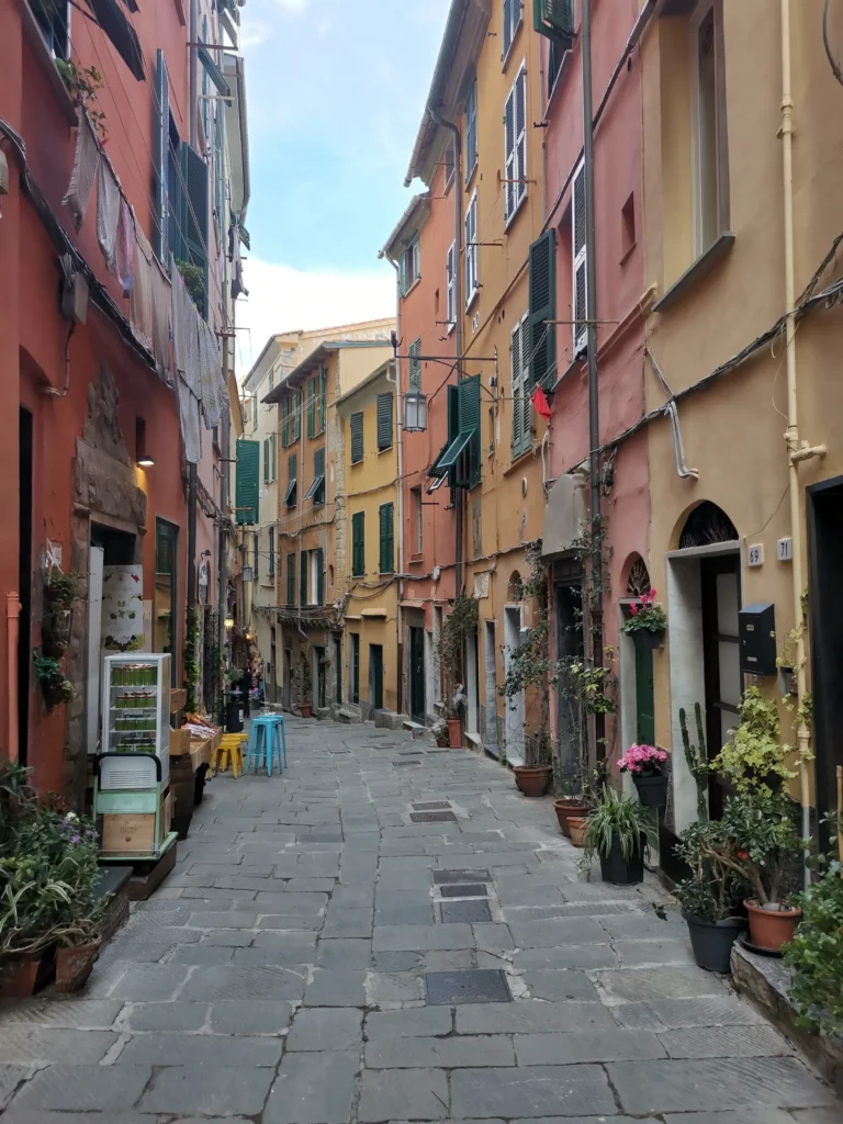
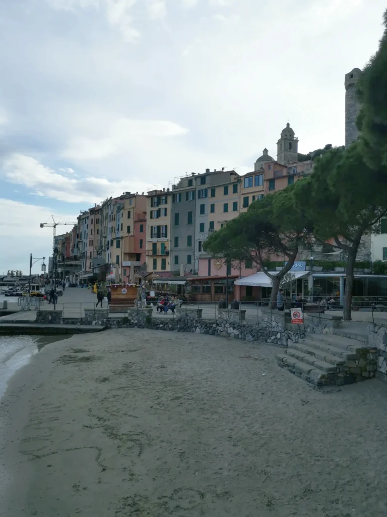
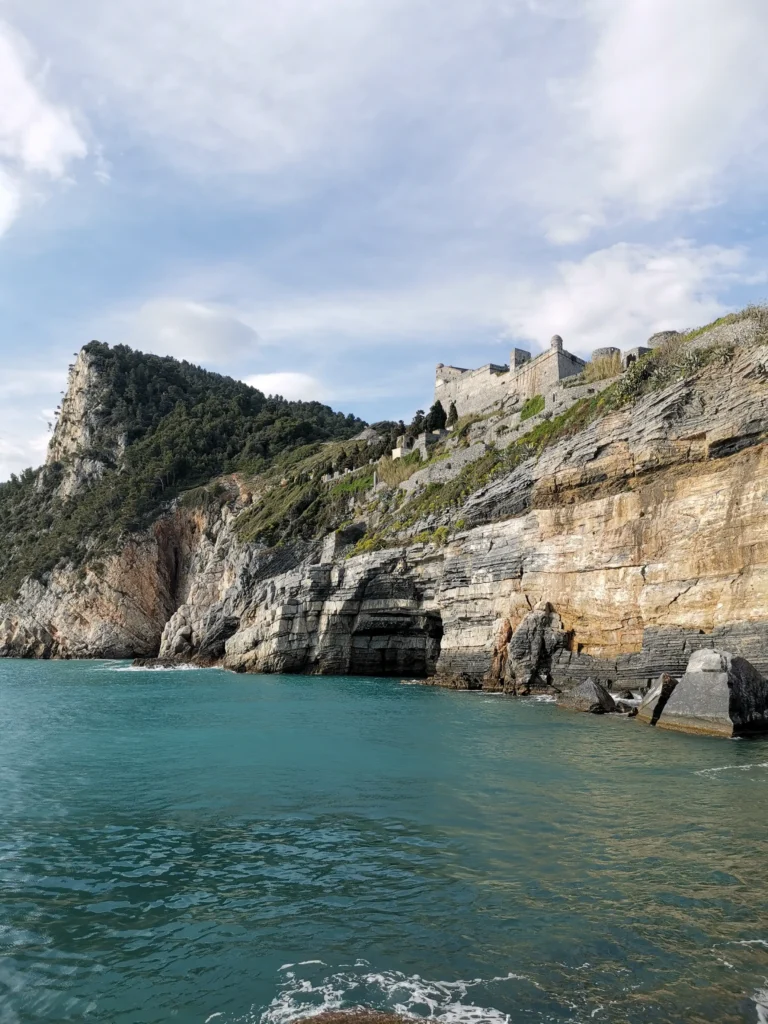
We spent another hour in the city wandering the colorful narrow streets. We arrived at Doria Castle, an imposing fortress built in the 12th century that offers impressive views of the sea and the village. Apart from these two activities, you can also see the Gothic church of San Pietro and Byron's Grotto, named after the poet Lord Byron, who meditated in the grotto.
From Portovenere you can take the boat to one of the villages, but you have to check carefully when the last boat leaves. We preferred to spend more time in the colorful harbor and admire the view, so we took the last boat to LaSpezia. The trip took about 30 minutes, and from the harbor in LaSpezia to the train station, it was another 30 minutes by walking. From there we took the train to Corniglia.
I hope this small guide has been helpful for you to better visualize this route and decide whether or not to put it on your itinerary. But I recommend you to keep it in mind because it is worth all the more sustained effort at the beginning and the longer time compared to the other routes. If you'd like to read about the other trails in the area, I invite you to visit the pages below. Please leave me a comment with any questions you have or if you need more details.


2 Comments